In the 17th century Tanbanio or Tabenjouw was a small village at the river Tanbanio at the south coast of Kalimantan. It was a strategic area with high economic potentials because of the pepper, fisheries, and the gold mines in Palaihari area, southeast of the fort.
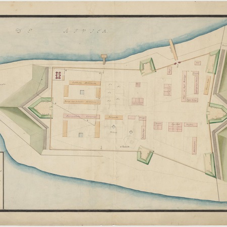
On July 6, 1779 the VOC signed a contract with the Sultan of Banjarmasin about the trade monopoly. Article 7 regulated the construction of a fort at Tabanio. The fort was an irregular quadrangle. In 1791 engineer J.C. Reimer designed a big fort on the same location. It is uncertain when the fort was build, but there are 19th century pictures the fort. Governor General Hendrik Willem Daendels (1808-1811) ordered the abandonment of the loss-making trading post on Kalimantan, including Tabanio. In 1816 the British refused to return the Dutch possessions, but both governments signed an agreement. In 1826 Sultan Adam of the Bandjarmasin realm made an agreement with the Dutch East India government in which he parted with the sparsely populates area around Tabanio (Tanahlaut). The fort was used by the civil government. In 1854 the government moved from Tabanio to Palaihari and the fort was abandoned. This part of Kalimantan became more and more important because of the coalmines which produced fuel for the growing number of steamships.
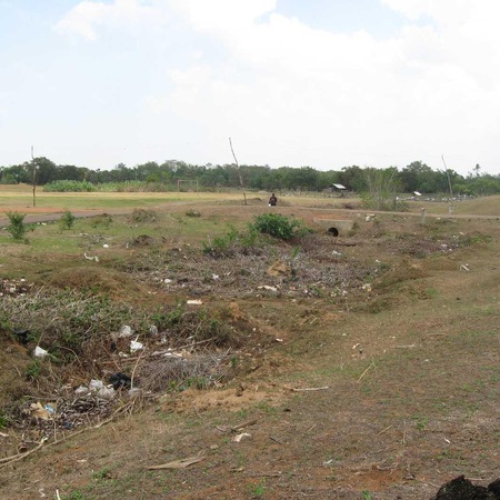
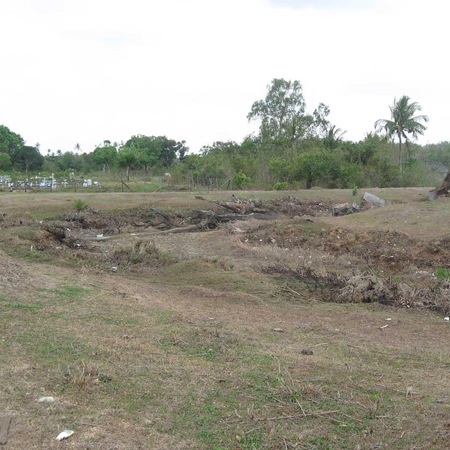
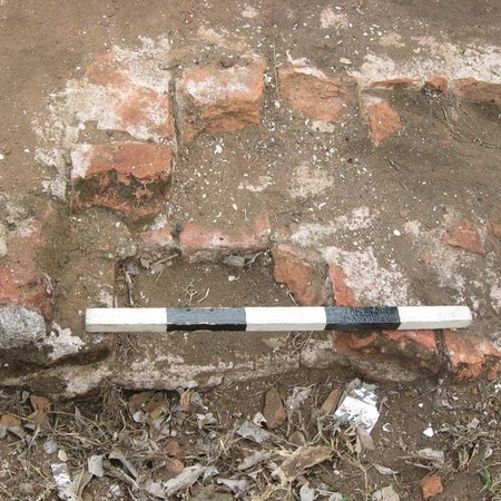
In May 1859 a revolt against the Dutch broke out, which was afterwards called the Banjermasin war (1859-1863). A group of rebels under Idris occupied the fort in Tabanio and murdered the post holder. Idris got the title of kiay demang Lehman, raised many supporters and became one of the most important leaders of the revolt against the Dutch. The Dutch retook the fort in August 1859. Fifty foot soldiers and two cannon were stationed in the fort. Tabanio became the basecamp for the pacification of the area. Fort Tabanio, which was listed as a fort of the 4the class (against a native enemy), was removed from the list of defense works of the Dutch East Indies. Today only the only remaining part of the fort is the moat. Archaeological excavations have revealed remains of the buildings.