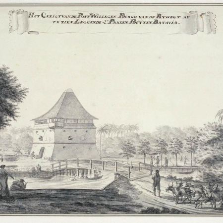
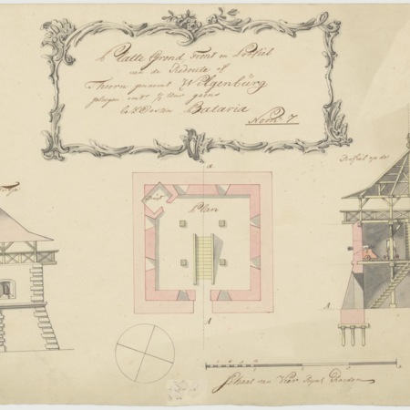
In a resolution of 30 april 1754, the VOC's High Government decided to construct Fort Wilgenburg. The fort stood on the junction of the road along the Kali Sontar and the road between between the forts Antjol and Jacatra. It was a stone redoubt with two diagonal bastions. It is also known as Dwars in de weg (across the road) because it was situated across the road along the Sontar. Wilgenburg stood near the bridge over the kali. It was demolished in 1809 by order of Governor General Herman Willem Daendels (1808-1811)
There are no no visible remains. On the modern map of Jakarta the site of Wilgenburg is at the intersection of Jalan Sawah Besar and Jalan Hidup Pademangan 4-5.